Place Name
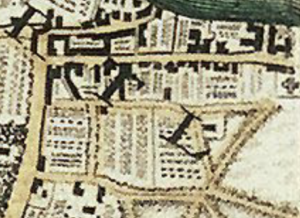
Formerly spelt Mullens, from a local family name, variously spelt Molin, Mollin, Mollins, and even Molings, who lived in the area from the 17thCentury. It is built on the arable strip of land formerly known as Ewe Furlong, alias Town Shott. Charles Hailstone author of Alleyways of Mortlake and East Sheen writes: “In 1623 Roger Mollins was an overseer of the poor. His son Richard was buried in the parish church three years later. In the 1630s Roger Mullins held a ‘messuage or tenement with the appurtenances thereto belonging’.” The first official mention of Mullens Path came in a lawsuit of 1659 after one local resident, by the name of Hardinge, took over a section when they expanded their garden, blocking the right of way. In Rocque’s 1746 map Mullins Path continued all the way up to Upper Richmond Road, near where Paynesfield Avenue is today. The small terraced cottages at the northern end were built in 1907.
![]()